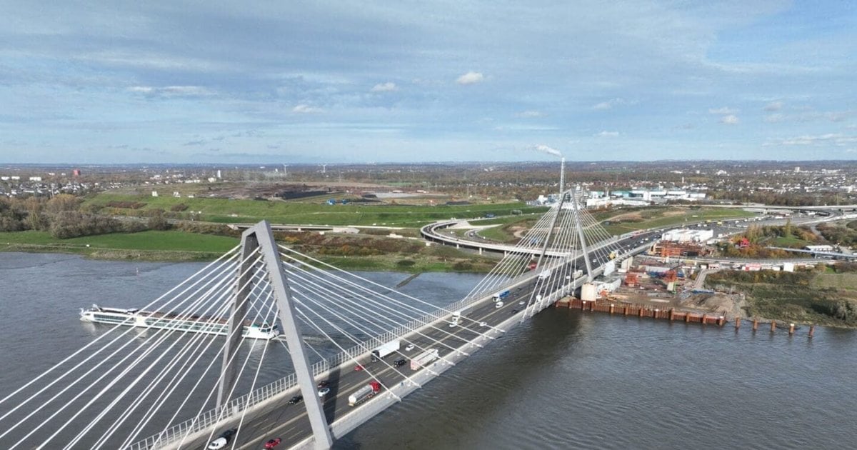
FindAdvertiseEditorialNews & ArticlesArticlesInterviewsTop 10Industry EventsVideosMagazinesReports & WhitepapersCompany ReportsTopicsConstruction ProjectsEPCFacilities ManagementTech & AIBuilt EnvironmentDigital ConstructionLIVE EventsSustainability LIVEProcurement & Supply Chain LIVEAI LIVEAdvertiseEditorialSocialsLinkedInTwitterFacebookInstagramYouTubeMediumArticleTechnologySkyports Drones Optimise HOCHTIEF Bridge ConstructionBy Aaron McMillanMarch 31, 2026undefined minsShareShareConducting routine aerial surveying of the Rheinbr’cke Leverkusen bridge in Cologne, Germany, technology will provide HOCHTIEF with next level data insights to accurately manage construction progress (Credit: Skyports Drone Services)Skyports automated drone-in-a-box streamlines surveying at HOCHTIEF's Rheinbr’cke Leverkusen bridge site in Germany, enhancing data accuracy & oversightSkyports Drone Services has partnered with HOCHTIEF to provide automated Beyond Visual Line of Sight (BVLOS) drone-in-a-box aerial surveying at the Rheinbr’cke Leverkusen bridge construction site on the River Rhine, north of Cologne, Germany.
In an innovative addition to the deployment, Skyports is overseeing its drone missions from its Remote Operation Centre (ROC) in Madrid, Spain, negating the need for on-site pilots and providing significant flexibility and efficiencies.
Alex Brown, CEO, Skyports Drone Services, says: “Large infrastructure projects are incredibly intricate and complex, with construction companies under pressure to deliver on time and on budget.
"With automated ?drone-in-a-box” surveys like this we’re providing alternate perspectives and deep level data insights that can improve resource planning and catch any potential issues early, helping keep projects on track.
Back in 2021, HOCHTIEF was awarded the contract by Autobahn GmbH to complete the Rhine Bridge on the A1 in Leverkusen. Working with partners SEH Engineering, Eiffage M’tal, Iemants and Max B’gl, the company has been tasked with completing a section of the roughly one-kilometre-long bridge by the end of 2023.
Until now, progress tracking had relied largely on manual, subjective checks. While some drone surveys were used, they were limited, infrequent and required on-site personnel. The new setup automates the process, removing the need for on-site pilots or access.